01
Read the bottom with Relief Shading
Bring humps, ledges and depth changes into view with colored bottom relief beneath the chart. Switch it on from Chart Tools with the stacked-layers button.
One app. From dock to spot.
Relief Shading, marine charts and VESS fishing windows. Together in ReelNav.
Smarter days on the water
See humps, ledges and depth changes with Relief Shading. Save your fishing spots, check VESS fishing windows, tides and weather, and keep charts and GPS tools close at hand from the dock to the next drift.
A closer look beneath the surface
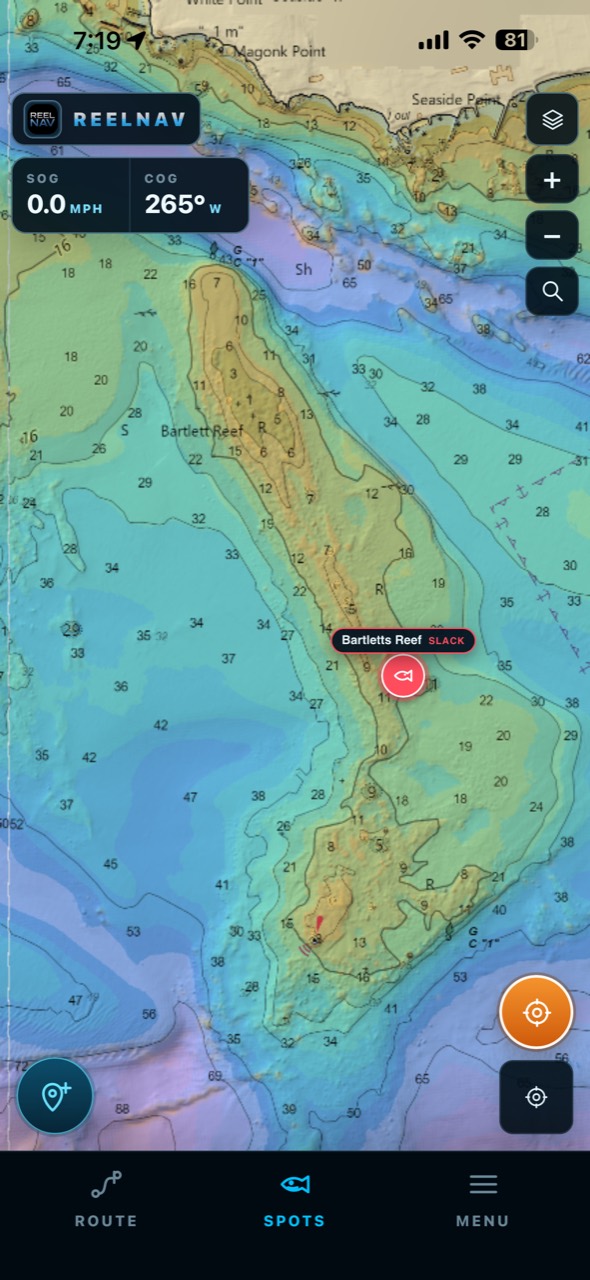
Relief Shading adds depth colors and shadows to help you recognize the shape of the bottom while keeping chart details in view. Explore a reef, follow a depth change, and save the structure you want to fish.
Turn it on in Chart Tools. Tap the stacked-layers button at the top right of the chart, then Relief Shading.
Bottom detail varies by location and available source data.
One trip. A clearer plan.
ReelNav helps you choose a window that fits the water before you spend the time and fuel getting there—then keeps the details that matter close at hand.
Bring humps, ledges and depth changes into view with colored bottom relief beneath the chart. Switch it on from Chart Tools with the stacked-layers button.
Search for a place or turn the latitude and longitude wheels to find your coordinates. Name the fishing spot, save it, and return to it from your spot library.
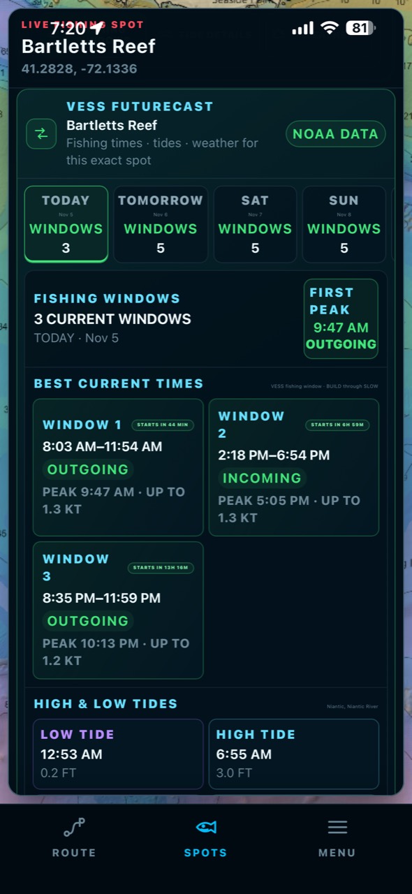
Compare predicted current stages at saved spots. See the build, peak and slow, then check upcoming fishing windows alongside tides and weather.
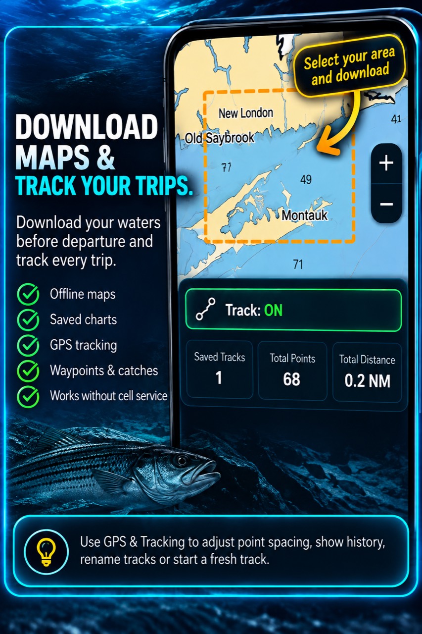
Keep marine charts, GPS position, routes and recorded tracks together. Save catches in your Fish Log and download chart areas before heading out of service.
Fishing spots, right on the chart
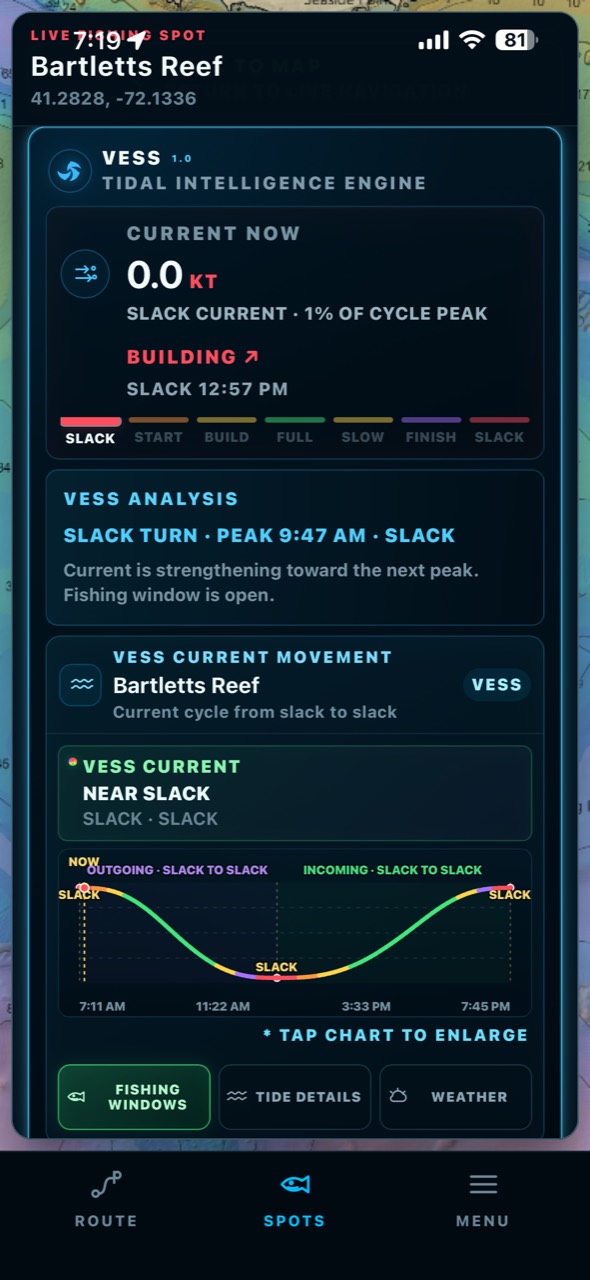
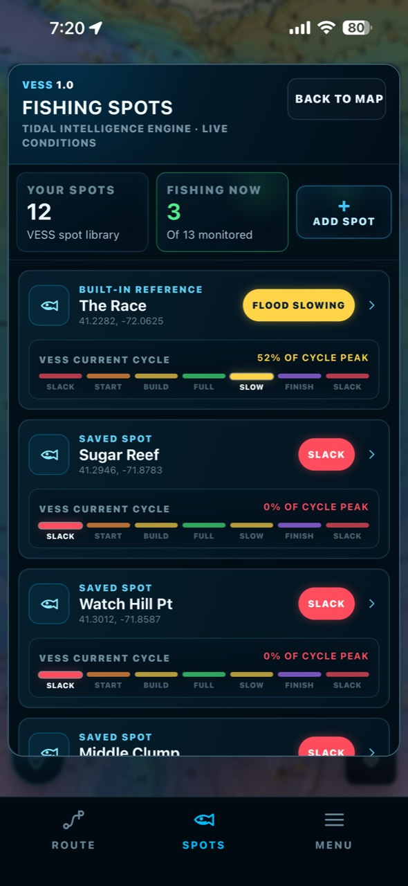
ReelNav keeps the places you save in one spot library, with current status you can compare at a glance. Open a fishing spot like Watch Hill Point to center it on the chart, or open its VESS detail to check the predicted current cycle and fishing windows.
Spot library Compare saved locations and their predicted current stages.
Coordinates made easier Use latitude and longitude wheels, then name and save your fishing spot.
VESS at a glance See predicted flood, ebb or slack at a saved spot. The animated map Currents feature is coming soon.
VESS tidal intelligence
ReelNav turns tide predictions and current stages into a clear view of what the water is doing now, what happens next and when stronger windows are expected at a saved fishing spot. Add wind, waves, weather and moon data, and you can plan around the whole picture—not a single number.
See the build. Follow current as it strengthens from slack.
Find the peak. Spot the strongest expected movement.
Know when it slows. See the next slack before you head out.
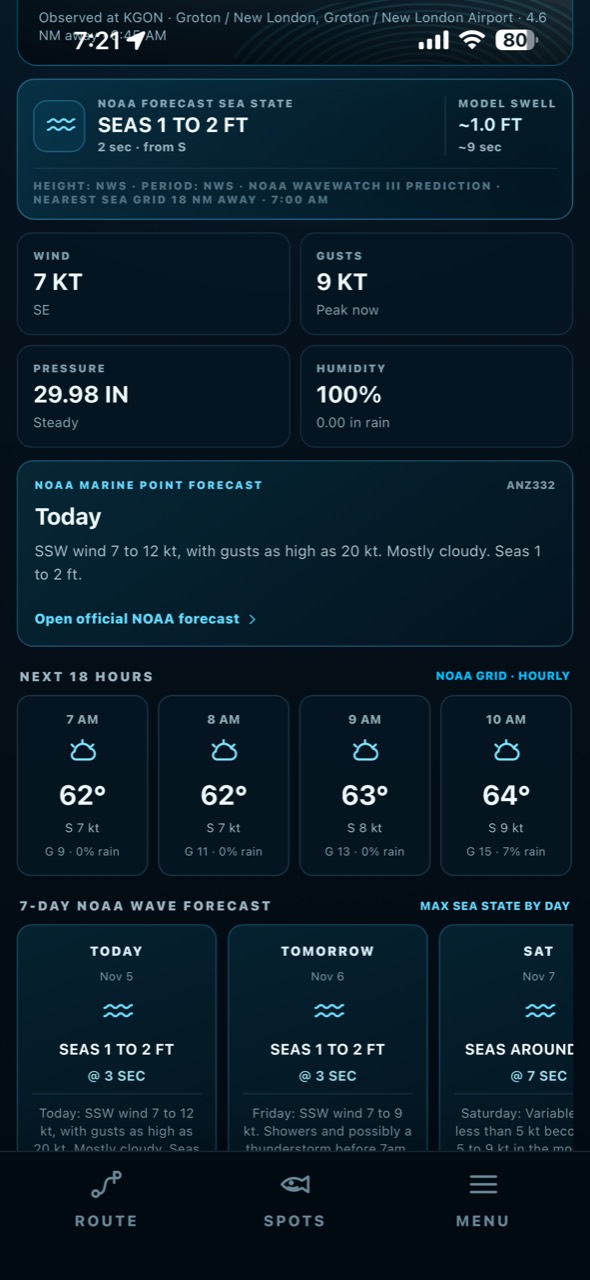
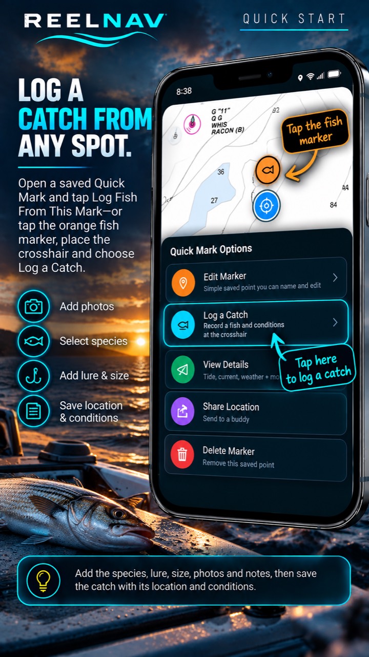
From the catch to the next trip
Log a catch with its location and conditions, download the waters you need, and keep a clean GPS track when cellular service disappears.
Fishing app? Yes. Boating app? Absolutely.
Even when the rods stay home, ReelNav makes tide and current movement easier to understand alongside charts, live position, routes and weather. From a quick harbor run to a full day on the water, more context makes planning easier.
“The tide was doing exactly what ReelNav said it was doing.”On-water testing · Connecticut
In development
Personal fishing insights built around your catch history. We're still working on this feature.
A dedicated current-flow layer for the map. We're still developing it; VESS spot predictions and fishing windows remain available separately.
About ReelNav
ReelNav is developed by ReelNav LLC, a Connecticut company creating practical marine navigation and fishing technology for boaters and anglers.
support@reelnav.comStay connected